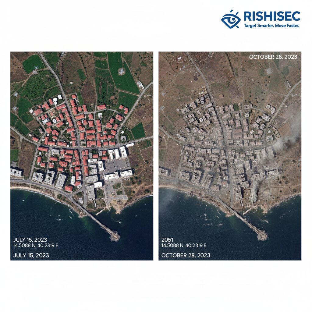
When ground access is denied and traditional investigative methods fail, satellite imagery becomes the silent witness to human rights violations. Satellite OSINT, which combines open-source intelligence techniques with geospatial analysis, has revolutionized how investigators document atrocities in conflict zones. From documenting destruction in Mariupol to verifying mass displacement in Tigray, overhead imagery provides irrefutable evidence that can withstand scrutiny in international courts.
Satellite OSINT refers to the collection and analysis of publicly available satellite imagery to verify incidents, track changes over time, and corroborate witness testimonies. Unlike classified military intelligence, these tools are accessible to journalists, NGOs, and human rights organizations. As a result, independent verification is now possible even in the world’s most restricted regions.
This investigative approach has become essential for organizations working in areas where governments deny access or actively suppress information. Additionally, satellite data provides temporal context that social media posts and eyewitness accounts cannot offer alone. When combined with AI-powered platforms like Kindi, investigators can map relationships between satellite evidence, ground reports, and witness statements to build comprehensive case files.
Why Satellite OSINT Matters in Human Rights Work
Independent verification stands as the cornerstone of credible human rights documentation. In censored or conflict-affected regions, traditional fact-finding missions face significant obstacles. Governments may restrict journalist access, intimidate local witnesses, or destroy physical evidence before investigators arrive. Satellite imagery circumvents these barriers by providing an overhead perspective that cannot be easily manipulated.
Organizations like Amnesty International’s Crisis Evidence Lab have used satellite OSINT to document systematic destruction of villages, verify unlawful detention facilities, and expose military buildups before attacks. Bellingcat famously used commercial satellite imagery combined with social media analysis to identify the Buk missile launcher responsible for downing flight MH17. Meanwhile, Planet Labs provides daily global coverage, enabling investigators to track changes in near real-time.

The value extends beyond conflict zones. Satellite evidence has documented illegal mining operations, environmental destruction affecting indigenous communities, and prison expansions in authoritarian states. Because satellite data includes precise coordinates and timestamps, it creates an auditable trail that strengthens legal cases. This approach complements traditional human rights OSINT investigations by adding verifiable geospatial context.
Core Tools for Satellite-Based Verification
Sentinel Hub and Copernicus Browser
The European Space Agency’s Copernicus program provides free access to Sentinel-2 satellite imagery through Sentinel Hub. This platform offers multispectral data with 10-meter resolution, updated every five days for most locations. Investigators can access historical archives dating back to 2015, which enables before-and-after comparisons of contested areas.
Learning to read spectral data enhances verification capabilities significantly. Healthy vegetation appears bright red in false-color infrared composites, while burned areas show as dark brown or black. Water bodies reflect differently across spectral bands, helping identify flooding or dried reservoirs. Cloud coverage remains a challenge; however, investigators can query multiple dates to find clear imagery of their area of interest.
The Copernicus Browser interface allows users to compare images side by side, adjust spectral bands, and download high-resolution files for detailed analysis. When investigating potential human rights violations, start by identifying your coordinates, then search for imagery captured within your timeframe of interest. Export relevant scenes for further examination using QGIS or other geospatial software.
Google Earth Pro for Historical Analysis
Google Earth Pro remains an essential tool for investigators who need to examine infrastructure changes over time. The platform aggregates imagery from multiple commercial satellites, offering historical views that sometimes extend back two decades. This temporal depth proves invaluable when documenting gradual patterns of displacement, destruction, or militarization.
The measurement tools within Google Earth Pro enable precise calculations of building dimensions, crater sizes, and distances between structures. Investigators can create overlays that mark specific features, then share these annotated files with verification teams. The timeline slider at the top of the screen allows rapid comparison of the same location across different dates, revealing patterns that might otherwise go unnoticed.

Combining Data with Kindi’s Link Analysis
Raw satellite imagery tells only part of the story. The real investigative power emerges when you connect geospatial findings with other intelligence sources. Kindi excels at this integration by allowing investigators to build link graphs that connect satellite evidence with social media posts, witness testimonies, and official statements.
For example, satellite imagery might show new structures appearing in a detention facility. By importing this data into Kindi alongside dates, coordinates, and image metadata, investigators can then link these findings to prisoner testimonies about facility expansions. Social media posts geotagged near the location provide additional temporal markers, while official government denials become nodes in the web of evidence.
This correlation approach strengthens verification confidence because multiple independent sources converge on the same conclusion. Kindi’s visualization capabilities make these connections visible to review teams and can be exported for reports submitted to international bodies. The platform also facilitates collaboration, allowing distributed teams to work on the same investigation while maintaining evidence integrity.
Step-by-Step: Verifying an Incident from Space
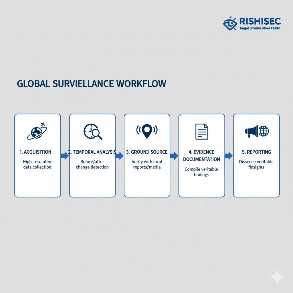
Successful satellite verification follows a methodical process. First, define your area of interest using precise coordinates, which you can obtain from witness reports, social media geotags, or open-source journalism techniques. Be as specific as possible because even small coordinate errors can lead to analyzing the wrong location.
Next, pull recent imagery from Sentinel Hub or Google Earth covering your timeframe. Compare temporal data by examining multiple passes over the same area. Satellites typically revisit locations every few days, so you can track changes at regular intervals. Look for structural changes, earth moving, vehicle concentrations, or other anomalies that align with your investigative hypothesis.
Overlay ground-based media for context. If social media users posted videos or photos from the area, use landmarks to confirm you’re examining the correct location. Building architecture, road patterns, and natural features help correlate ground-level footage with overhead imagery. This triangulation significantly increases verification confidence.
Use Kindi to connect images to sources, reports, and entities. Create nodes for each piece of evidence including dates, sources, and confidence levels. Link these nodes to build a visual representation of your investigation. This graph becomes your evidence map, showing how different intelligence sources support or contradict each other.
Finally, archive all findings with precise timestamps, metadata, and coordinates. Document your methodology, note any limitations in image quality or coverage, and preserve original files. This chain of custody ensures your evidence remains defensible if challenged. Export your Kindi graph and satellite imagery package together for comprehensive documentation.
Common Pitfalls and How to Avoid Them
Satellite verification requires careful attention to detail because misinterpretation can undermine credibility. Shadows cast by buildings or terrain can resemble structures that don’t exist, especially in low-sun-angle imagery. Always examine multiple images from different dates and times to confirm features are real rather than optical effects.
Vegetation changes often confuse inexperienced analysts. Seasonal growth patterns, agricultural cycles, and natural succession can dramatically alter landscapes without human intervention. Before concluding that vegetation loss indicates destruction, research the area’s typical seasonal patterns and compare against previous years during the same season.
Compression artifacts in publicly available satellite imagery sometimes create false patterns. When resolution degrades or compression algorithms process images, they may introduce visual noise that resembles vehicles, structures, or other features. Cross-reference suspicious findings with higher-resolution imagery when available, or note limitations in your analysis.
Confirmation bias poses perhaps the greatest risk. When investigators expect to find evidence of specific violations, they may unconsciously interpret ambiguous imagery to support their hypothesis. Combat this by establishing verification criteria before examining imagery, using blind analysis where possible, and inviting peer review from analysts unfamiliar with the case.
Privacy and security implications deserve careful consideration. Publishing satellite imagery with precise coordinates can endanger survivors, reveal safe houses, or expose ongoing operations. Consult with affected communities and security experts before releasing geospatial data. Blur or crop imagery when necessary to protect sensitive information while still supporting your investigative conclusions.
Ethical and Legal Dimensions
The United Nations has developed guidelines for using remote-sensing data in human rights investigations, emphasizing the need for transparent methodologies and careful interpretation. These standards help ensure that satellite evidence meets admissibility requirements in international legal proceedings. Investigators should familiarize themselves with protocols established by organizations like the UN Office of the High Commissioner for Human Rights.
Maintaining chain of custody for digital evidence requires rigorous documentation. Record exactly when and how you acquired each image, note any processing or analysis performed, and preserve original files in multiple locations. Hash values should be calculated and stored to prove files haven’t been altered. This meticulous approach ensures evidence integrity throughout the investigative and legal process.
Responsible disclosure protects survivors while holding perpetrators accountable. Before publishing findings, consider whether your report could trigger retaliation against vulnerable populations. Coordinate with local organizations that understand community risks. In some cases, sealed evidence submitted directly to international courts proves more appropriate than public reports.
Obtaining informed consent from affected communities represents best practice, even though satellite imagery doesn’t require individual permissions. Community leaders should understand how their situation will be documented and disseminated. This participatory approach respects dignity while strengthening the legitimacy of human rights work.
Seeing Truth from Orbit: The Future of Satellite OSINT
Satellite OSINT has fundamentally changed how the international community documents human rights violations. No longer can perpetrators hide behind closed borders or media blackouts. The combination of accessible imagery, sophisticated analysis tools, and collaborative platforms creates unprecedented accountability mechanisms. Organizations worldwide now possess the capability to independently verify claims and build evidence bases that support justice efforts.
Looking ahead, artificial intelligence will further enhance satellite analysis capabilities. Machine learning models can now automatically detect destroyed buildings, identify vehicle types, and flag unusual activities across vast areas. Synthetic Aperture Radar technology penetrates cloud cover and operates at night, eliminating weather and time constraints. These advances promise to make verification faster and more comprehensive.
However, technology alone cannot ensure accountability. Human analysts who understand context, apply ethical frameworks, and combine multiple intelligence sources remain essential. Platforms like Kindi amplify these human capabilities by organizing complex investigations, facilitating collaboration, and visualizing connections that might otherwise remain hidden.
Want to integrate satellite OSINT with comprehensive link analysis? Try Kindi to connect geospatial evidence with your broader intelligence picture and accelerate human rights investigations.
Looking to strengthen your OSINT capabilities for human rights work? Check out our OSINT courses for practical, hands-on training in satellite analysis, geolocation verification, and open-source investigation techniques.
FAQ
What is satellite OSINT in human rights investigations?
Satellite OSINT involves using publicly available satellite imagery to verify human rights violations, document destruction, and corroborate witness accounts. Unlike classified intelligence, these open-source tools are accessible to journalists, NGOs, and investigators worldwide, enabling independent verification even in restricted regions.
Which free satellite imagery sources are most reliable for verification?
Sentinel Hub provides high-quality multispectral imagery updated every five days through the European Space Agency’s Copernicus program. Google Earth Pro offers historical imagery extending back decades. Both platforms are free and have been used successfully in major human rights investigations by organizations like Amnesty International and Bellingcat.
How do investigators avoid misinterpreting satellite imagery?
Successful verification requires examining multiple images from different dates to distinguish real features from shadows or artifacts. Analysts should understand seasonal patterns, use multiple spectral bands, and always cross-reference satellite findings with ground-level evidence. Peer review and transparent methodologies help prevent confirmation bias.
Can satellite evidence be used in international courts?
Yes, satellite imagery has been admitted as evidence in international tribunals when proper chain of custody is maintained. Investigators must document acquisition methods, preserve original files, calculate hash values, and follow UN guidelines for remote-sensing data. Transparent methodology and expert testimony strengthen admissibility.
How does AI improve satellite OSINT for human rights work?
Artificial intelligence can automatically detect infrastructure changes, identify vehicle types, and flag potential violations across large areas. Platforms like Kindi use AI to connect satellite findings with other intelligence sources, building comprehensive evidence networks. However, human analysts remain essential for contextual interpretation and ethical decision-making.

